
five New MBTA Lines and Urban Revitalization Projects
Our state has an issue of not enough housing and too much traffic. But by building five new tram lines in Greater Boston, we’ll open up corridors for economic development, including: more housing, small businesses, big businesses, ‘third spaces,’ green spaces, rapid transit, and countless other opportunities - all ultimately fixing many of our problems and improving lives.
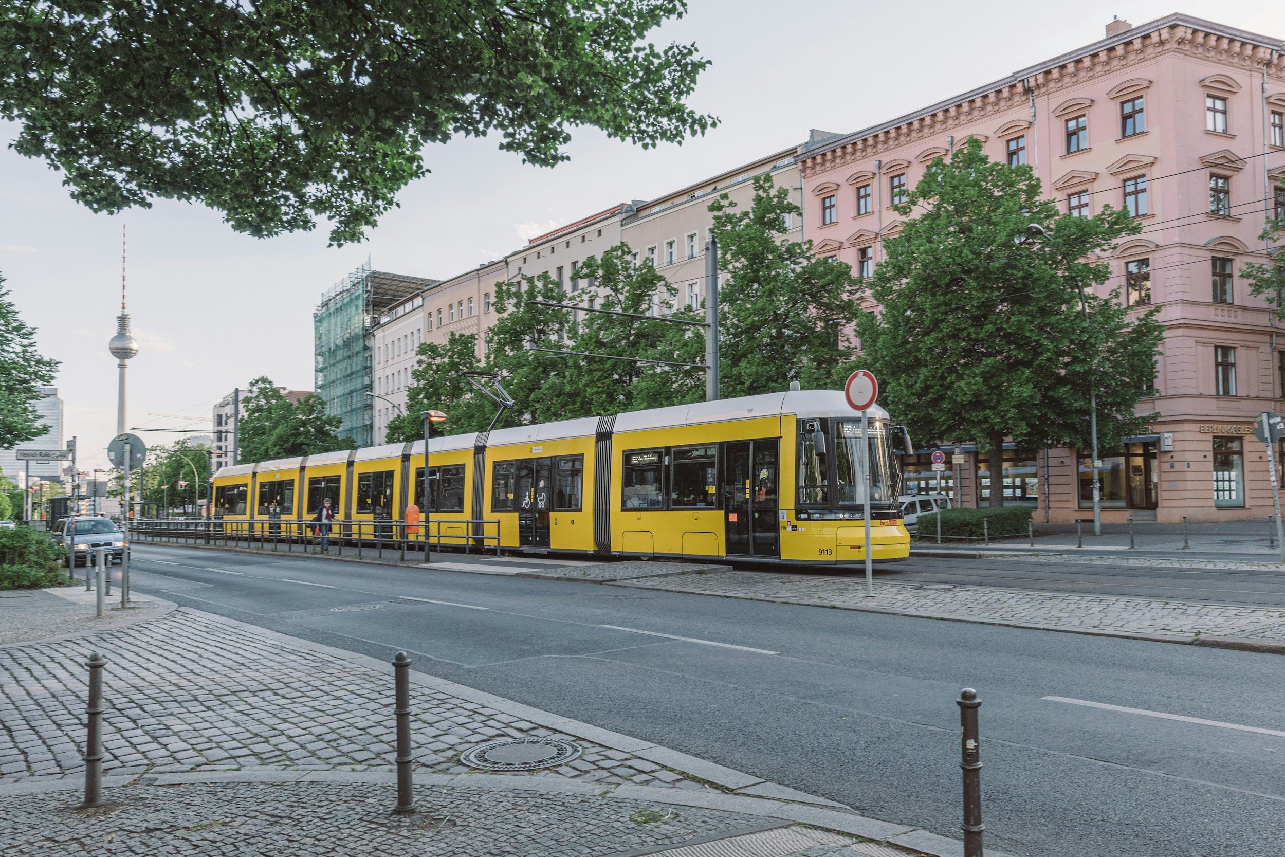
Trams are quiet, above ground, light rail trains that best serve mid/high density urban areas. They streamline city transit, reduce traffic, connect larger rail lines, and speed up commutes for everybody. They’re what the MBTA is missing and they’re exactly what we need to build in Greater Boston.
What’s a Tram?
Not only will these trams line help us solve our transit problems, but just as importantly, they’ll bring the additional benefit of unlocking thousands of acres for economic development that will create jobs, housing, and social opportunities - all making our state even better.
Step 1: Build Five New MBTA Tram Lines (pink)
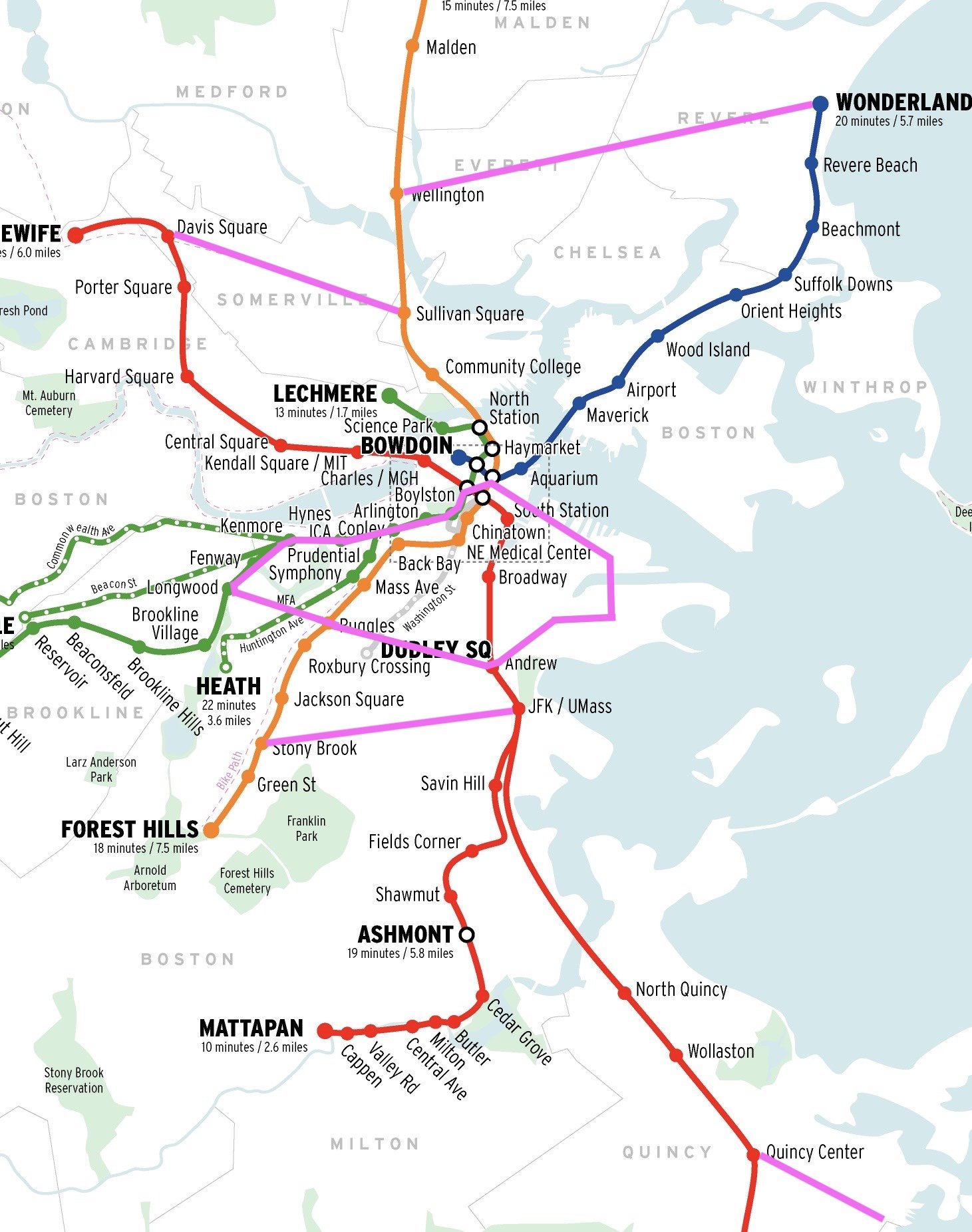
Although we need to run feasibility studies and to determine optimal routes, I propose 5 new MBTA tram routes that will best connect our city and stimulate enormous economic growth. (New Tram Lines in Pink above).
Specifically, those five new tram routes are:
A tram rail looping around downtown Boston, connecting all MBTA lines and all of Boston’s neighborhoods, making Boston the most transit oriented city in the country. (9 Miles of rail, going from Andrew, down Melina Cass, to Ruggles, to Longwood, to Fenway, down Newbury, around the Commons, to Government Center, down State Street, through the Seaport, to Southie, down Broadway, back to Andrew).
A tram rail from JFK Mass to Stony Brook Station (3 miles of rail;
A tram rail from Davis Square to Sullivan Square (3 miles of rail going down College Ave then down Broadway Street);
A tram rail from Quincy Center Station, to Howard Street/Quirk (2 Miles going all the way down Quincy Avenue)
A tram rail from Malden Station, across Everett, to Revere Beach Station (4 Miles)
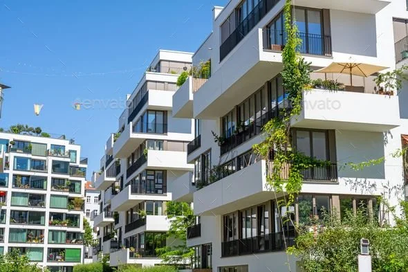
Step 2: Build tree-lined Boulevards with Mixed Use Zoning for housing & businesses along the Tram routes
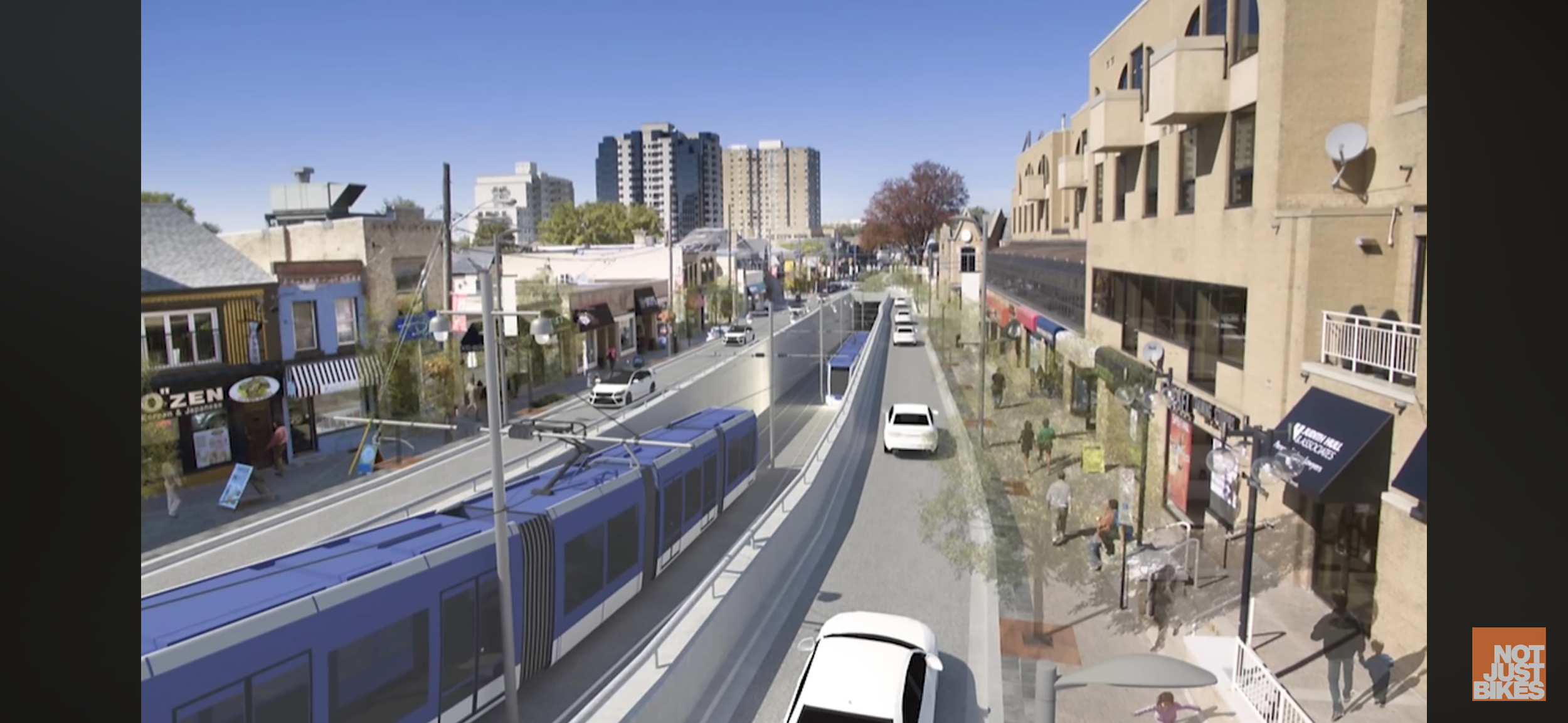
Along these new tram routes, we’ll build beautiful, walkable boulevards, with 2-4 lanes for cars, ample parking, wide sidewalks, and bike lanes - which will improve transit, reduce traffic, and circulate more money in our local economy.
More importantly, these boulevards will serve as catalysts for economic growth and open up over twenty square miles of welcoming corridors for more people, more housing, and more businesses, both big and small.
Even better, with this transit oriented development we’ll turn these currently under-utilized, under-connected areas of our state into vibrant, desirable communities, making both Greater Boston and Massachusetts an even more attractive and enjoyable place for people to live and businesses to operate.
Step 3: Incorporate Car-free City Squares and vibrant downtowns for community and small businesses
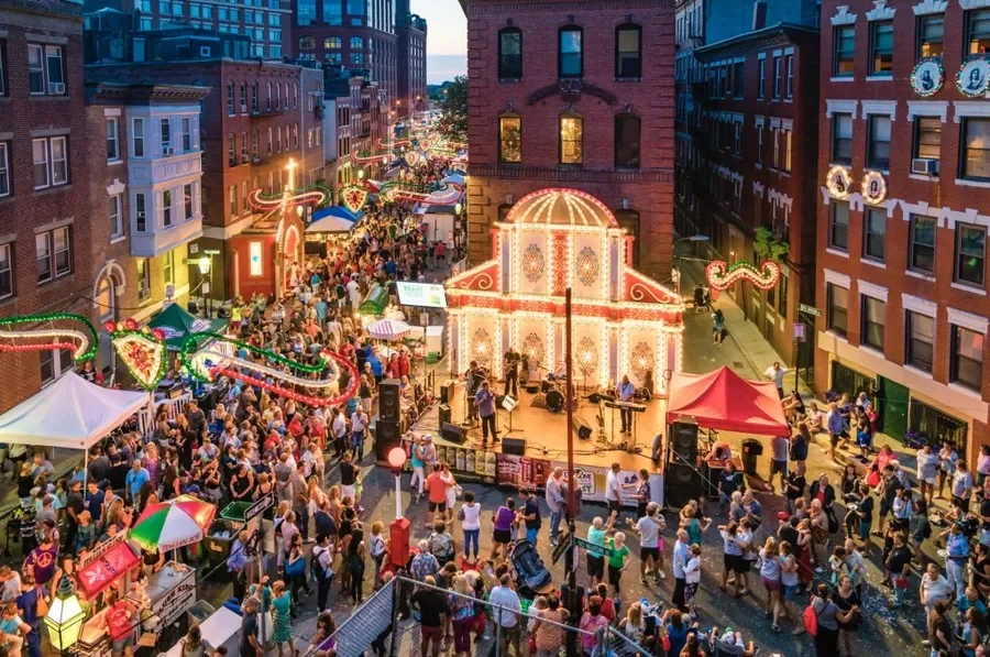
Along the tram routes, at the stations (~every .4 miles), we should build beautiful, safe, and walkable downtowns and public squares that pull us together.
Think of Davis Square, Downtown Salem, or the North End, but now imagine them without all the cars and with more outdoor seating. Those areas would be examples of vibrant, car-free, downtowns - and that’s precisely what we should design along the tram rails/boulevards, naturally around the tram stops.
These downtowns and squares will create centralized areas where people, businesses, and experiences can meet - creating the third-spaces and lively public vibrance that our modern cities and suburbs are desperately missing.
Specifically, we should design these areas to maximum sunlight and minimize wind tunnels, and then fill the concentrated areas with: restaurants, local businesses, grocery stores, gyms, specialty stores, art studios, green spaces, monuments, hotels, and venues for live music, comedy, and entertainment.
By building these transit-oriented public squares, we’lll create fun, lively, welcoming, and vibrant public spaces that pull people together, build community, and make life better for all of us (…and we’ll grow the economy and help small businesses).
So, for those reasons, we should emphasize incorporating these city squares into our urban plans.
FInal Step: Allow the free-market to “fill in the gaps” and build a lot more housing and commercial space
Once the state lays down the foundational infrastructure and provides the urban/zoning plan of tram lines, boulevards, and public squares, we’ll open up tens of thousands of acres of land for mid/high density, mixed-use development of lots of desirable housing and commercial space.
Of course, to guide this development, we should outline regulations and zoning for: mid/high density zoning; building height limits of 5 stories; and impose aesthetic standards that produce attractive buildings (as to avoid those big, ugly, monotonous, gray, communist blocks that we see today).
Then, within those parameters, we can then allow the free-market to build whatever they want to meet the public’s demands for housing/commercial space, which will literally fill in the gaps along the main boulevards/tram routes between stops and public squares.
With this strategy, we’ll meet our housing demands, fix traffic, and ultimately build desirable, vibrant, and convenient neighborhoods for people to live and work.